
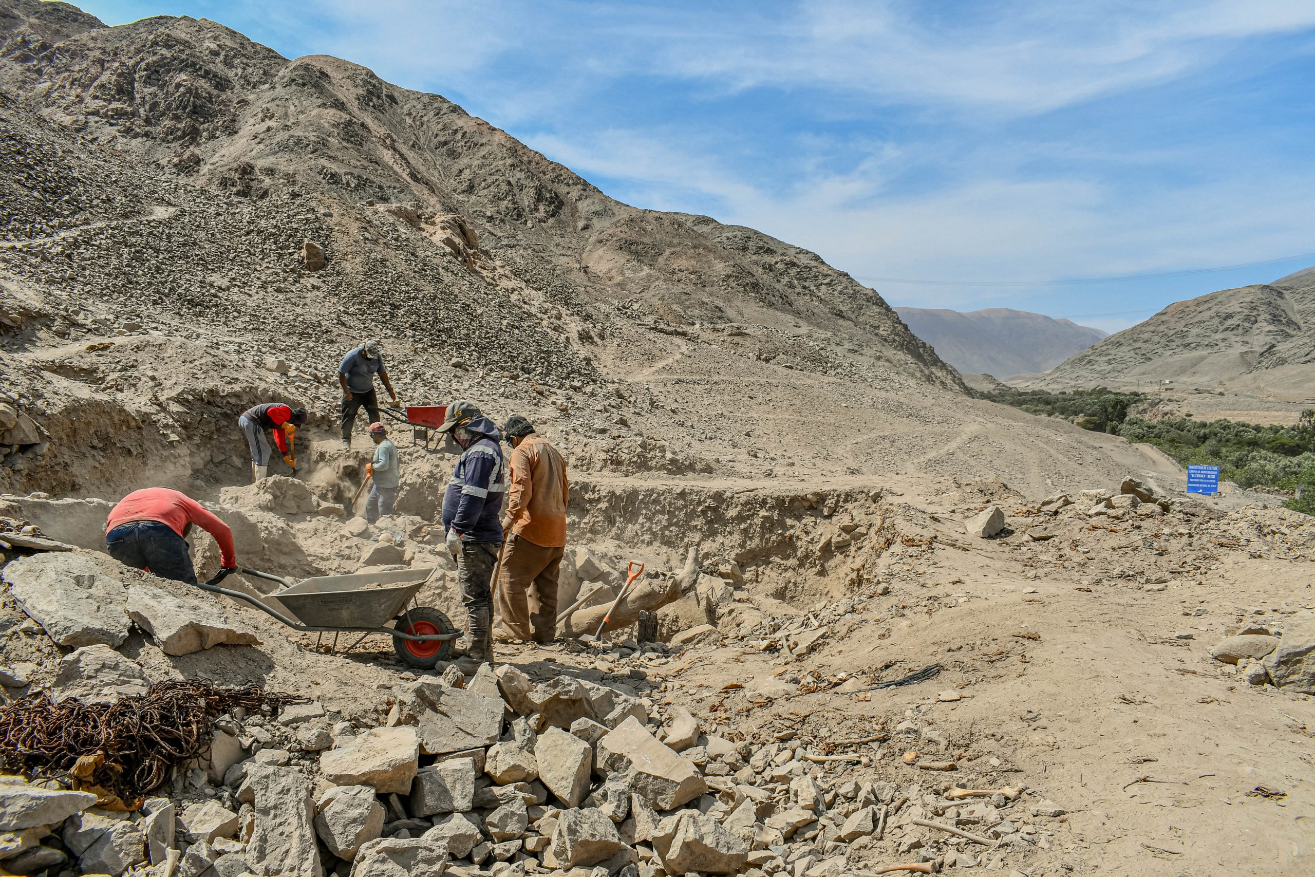
About the Project
The project, funded by the National Science Centre (Poland) and conducted by a Polish-Peruvian research team, is a pioneering and comprehensive endeavour aimed at uncovering the history of this region.
The goal of the project is the identification and thorough analysis of pre-Columbian settlement in the Atico river basin, located at the northern edge of the Peruvian coastal zone known as the Costa Extremo Sur.
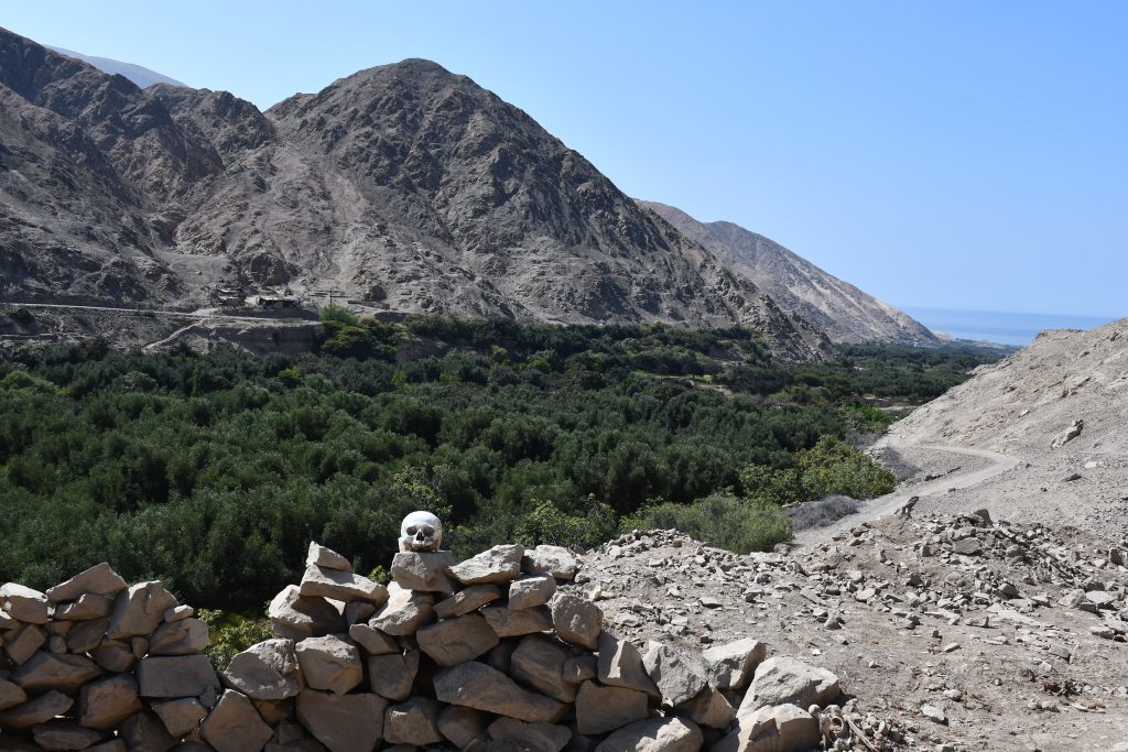
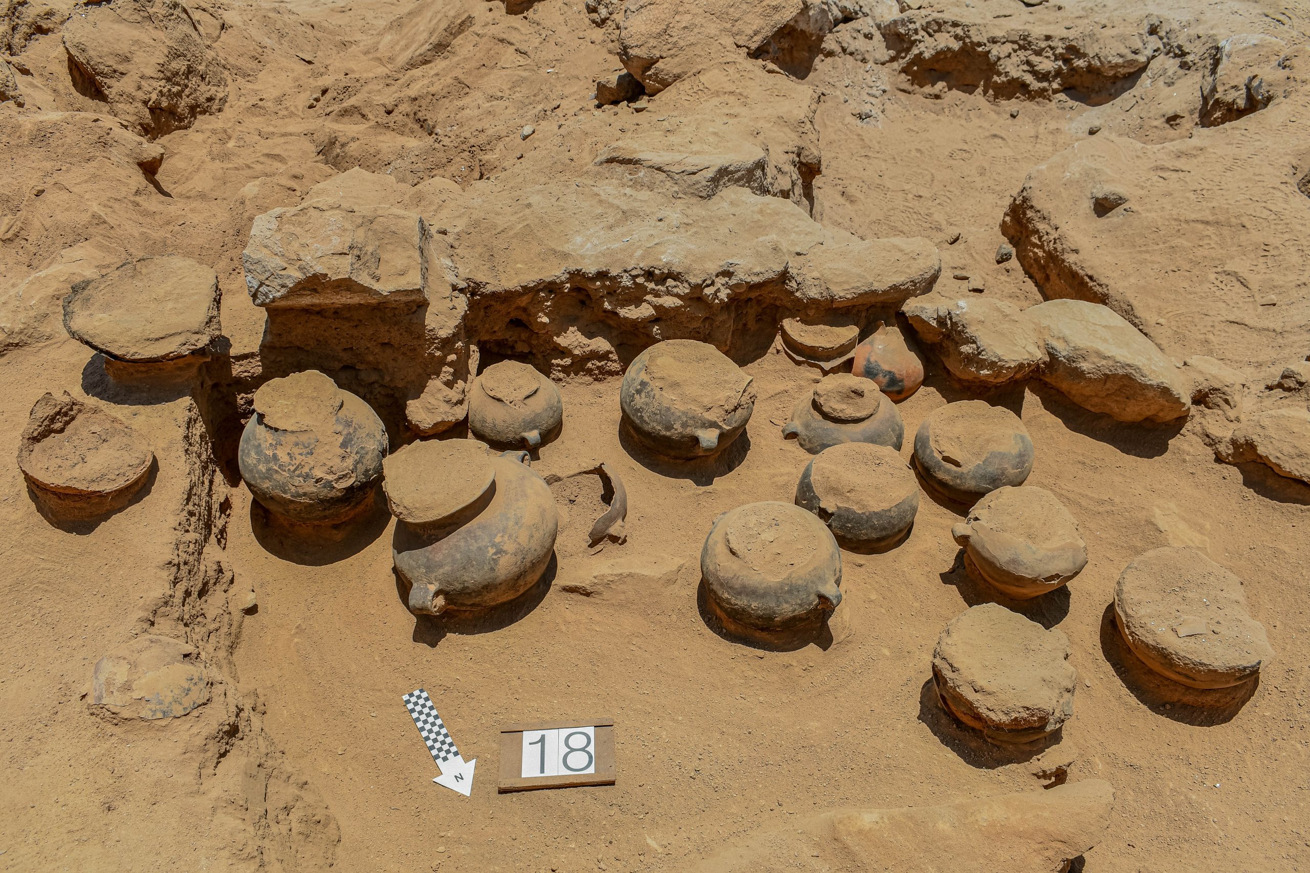
Here, at the intersection of mountain and desert environments, the influences of the Paracas and Nasca cultures from the north mingled with those of communities inhabiting the southernmost valleys of the Peruvian coast. Despite this unique location, the Atico basin remains almost entirely unexplored archaeologically. The documentation of the Peruvian Ministry of Culture contains only sporadic references to rock art sites in the mountains, fragments of Inca roads, and shell middens belonging to fisher-gatherer groups along the coast.
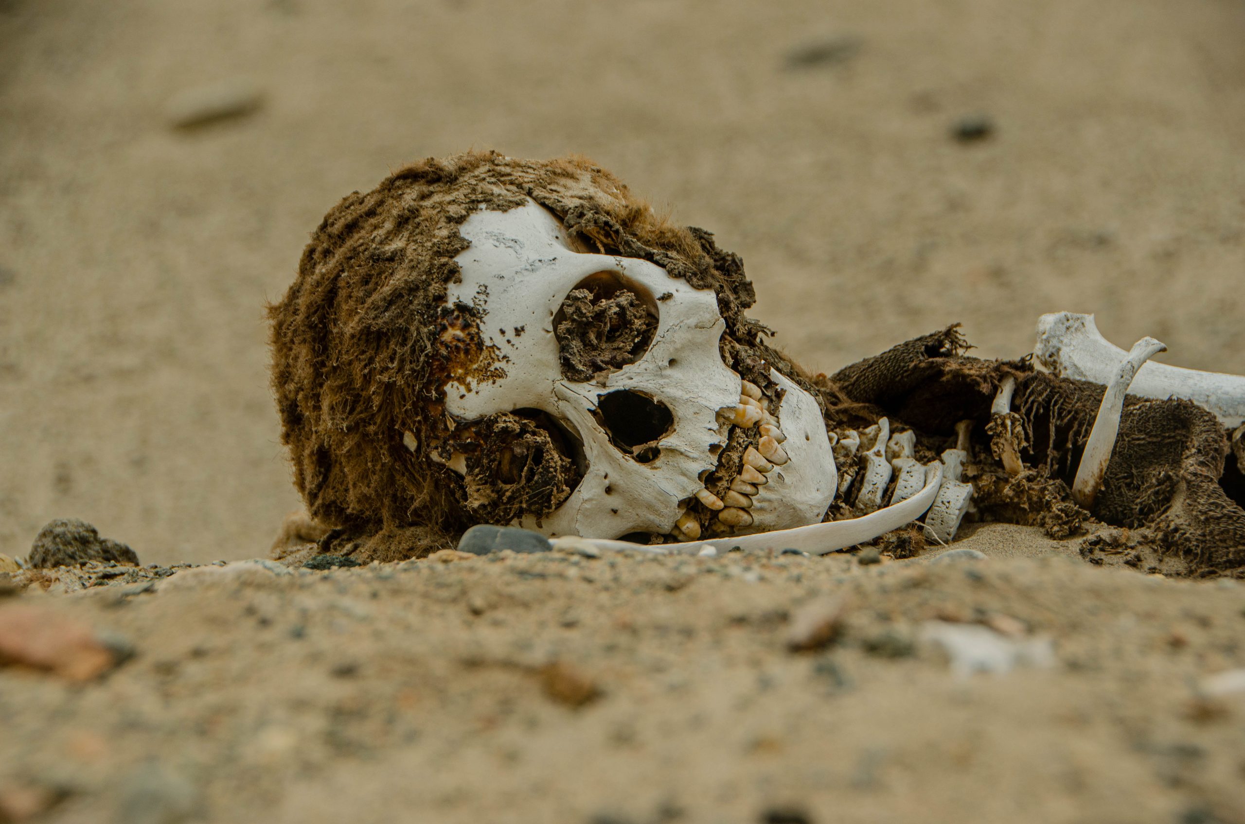
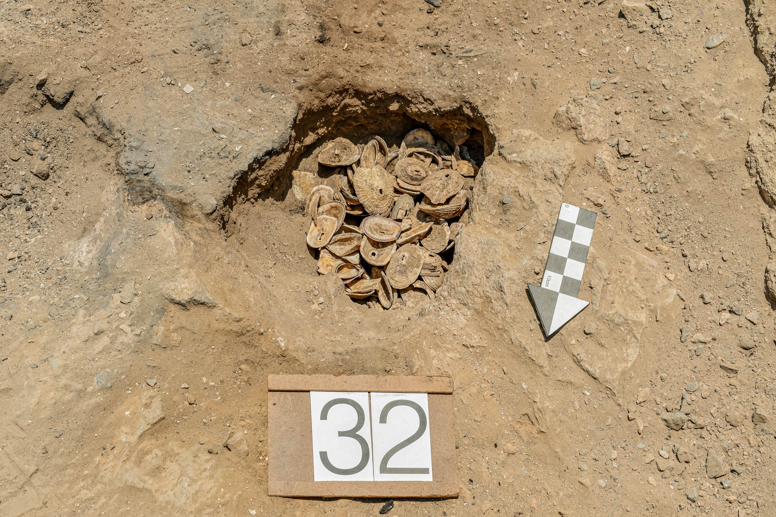
It was not until 2017 and 2019 that a Polish-Peruvian archaeological expedition undertook the first reconnaissance to evaluate the research potential of the Atico valley. During these surveys, caves with rock paintings and evidence of early hunter-gatherer occupation were discovered, as well as numerous sites indicating continuous habitation from the Formative Period through the expansion of the Wari Empire. At one of the key sites, El Curaca, researchers identified ceramics similar to Formative materials from the Tambo and Quilca valleys, as well as artefacts linked to a previously undefined culture of the Late Intermediate Period.
The project is interdisciplinary in scope—besides archaeologists, the team includes experts in settlement geography, botany (palynology), physicochemical sciences, as well as isotopic and ancient DNA (aDNA) analyses. The research aims to reconstruct settlement and cultural transformations in their spatio-temporal dimension, and to assess the impact of external influences—migrations and intercultural contacts—on the shaping of the local cultural landscape. A particularly innovative aspect will be the creation of the first detailed map of pre-Columbian settlement in the region using Geographical Information Systems (GIS).
The analyses will also utilise results of genetic (aDNA) studies, enabling the investigation of the relationships between populations associated with particular archaeological cultures. The comparative context will be provided by the results of ongoing laboratory analyses of 147 samples from the Tambo and Acari river basins at Adam Mickiewicz University in Poznań.
The results obtained will contribute not only to a deeper understanding of the development of pre-Columbian communities in the Atico catchment in relation to environmental conditions, but also provide valuable insights for broader discussions regarding human–environment interactions, the role of migration, and the significance of cultural interaction in the formation of ancient societies of southern Peru.

